|
GROUP JOURNAL FOR MELITOUR EASTERN TURKEY TOURJULY 29,2001 TO AUG 12 , 2001 |
|
|
GROUP JOURNAL FOR MELITOUR EASTERN TURKEY TOURJULY 29,2001 TO AUG 12 , 2001 |
|
| Day
06 Saturday, Aug 04
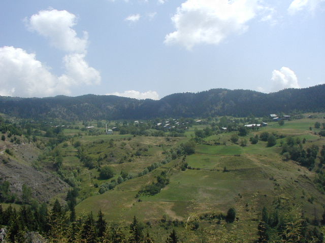
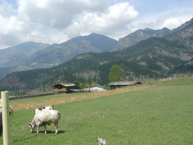
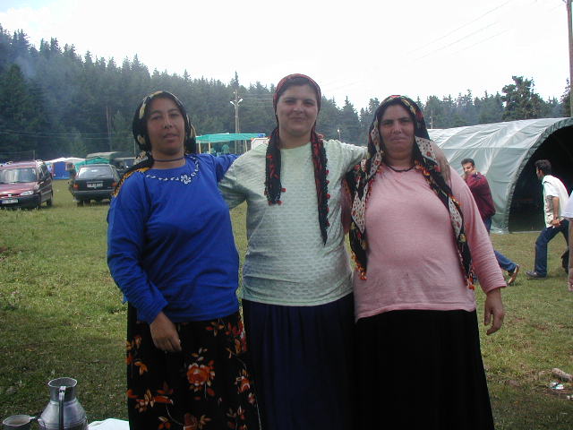
Nina Dougherty's ARTVIN YAYLA FESTIVAL ARDAHAN KARS "Taking the Silk Road towards Kars (from Artvin) via the Lonely Pine Forest…By sunset, we will be driving by a lake which will be catching the last rays of the sun as we drive into Kars." The above brief entry for this day in the trip itinerary brochure indicated a peaceful travel day of getting from here to there. The reality was far more eventful. The day can be described as going from dam building near cliff clinging Artvin to dung constructions near Kars. From precipitous mountains with hairpin turn roads to rolling steppes--and, in between, there was the unexpected unforgetable homecoming festival in a lush mountain valley near the Georgian border. Breakfast is in a room with quite a view--from the steep slopes on which our Artvin hotel clung to the equally steep slopes across the valley far below. We see not only dramatic mountainous scenery but also man busy at work gouging out the valley below and adjacent vertical mountain sides to construct a large dam. The dam is one of three being built now with two more planned. The cost of each is stated as $750 million, which seems like an unrealistically low estimate, given the scale of the work. Private companies obtained loans from Switzerland and Austria to fund the dams. There is a fear that the companies will declare bankruptcy and the results will be devastated sloes rather than a dam The unexpected events begin when we stop to take pictures of workers manually building a rock retaining wall along the steep slopes of the new road. Three men in a car also parked there turn out to be the Director of Tourism for the Artvin province, the Artvin Archeologist (also professor at the Centennial University in Van) and the Artvin Director of Folklore. Meli persuaded the latter two to ride with us and tell us about the area. In addition to giving expert information on Artvin archeology and folklore and the dam that dominates the landscape, they mention they are going to a big homecoming festival in the mountains, sort of along our route. Meli says to us, "Do you know what I'm thinking?" We unanimously reply, "Yes, let's go". We are told by our guests that much cultural heritage will be inundated by the dam and that the country as whole doesn't appreciate these values. However, the archeologist said he coodinated in his mind all aspects--persons selling houses, benefits of the dam and the cultural heritage that might be lost. He attends international conferences but since what is to be protected here isn't like the Aswan Dam situation, the international support is verbal and not financial. The cultural heritage of the area is from the Georgian Bagratids who reigned in the area until the 16th century when the Ottoman Empire took over. They are related to, but separate from the Armenian Bagratids. Their most wonderful works of art are 15 monasteries, which, along with fortresses, are high on the mountainsides, safe from water from the dam. The fortresses guarding this branch of the Silk Road. Artvin were built on the crossroads of trade routes between the Caucasus and Anatolia. He said Artvin had the lowest crime rate in Turkey, the highest education level and the highest number of bears--black, yellow and the rare white grey bear. Now we switch to vans and maneuver our way up a narrow, winding road to a lovely small village of wood chalets, and on up through guarding soldiers (who examine our passports) to the festival in a higher yet meadow. People are already camped out and picnicking on the perimeter of the meadow. Truck loads of summer homecomers to the surrounding villages continuously arrive, jump out of the trucks and hug friends. Most of them live and work in Istanbul, Ankara and Izmir the rest of the year. People run up and greet their friends among the newcomers. Food and sundry stands encircle the central meadow where musicians, dancers and politicians are warming up and where the festivities will occur. People are friendly. They invite various of us to their tents and to take pictures. We eat our picnic lunch at the end of a long table. There are maybe 2000 people now--more continuously coming--and armed soldiers everywhere to protect festival goers from any threats. Then, all too quickly, it is time for us to go. On the way to Savsat we pass a hilltop fortress that was used to guard this branch of the Silk Road. After the hillside town of Savsat we begin climbing out of the forested valley. The landscape is rather Bavarian, as is the lovely wayside inn at which we stop for cai and bira. Brick inn, "bira" sign, tiers of tables along the stream. Busy spot. Then on to Ardahan. Acute hair pin turns. We pass through a yayla to a high vertical cliff with steep slopes of cropped grass sweeping down to a deep cleft. Then another yayla and on to the 2640 meters high Camlibel Gecidi pass (where group pictures were taken). After that a descent to the grass covered slopes and plateaus of the steppes as we approach Ardahan. And now Ardahan--a village of 15,000 that was made into a city in order to get a complete military squad to meet threat of terrorism. Grass covered stone houses. Impressive fortress across the river from the town. Soldiers everywhere. We pass a roadside stone watch tower with gun(s) held at the ready. We're close to the Georgia border. All of the border is heavily militarized. A picture of Ataturk with a patriotic message is painted on the hillside: "We will go on the path you chose or we will die for you." After Ardahan, lots of traffic. Another festival. More beehives. Cars, trucks, buses parked either side of road into the pastures. Military vehicles, including tanks. Soldiers stationed every 50 feet or so. Question: "Why such a good highway for such little traffic?" Answer: "Military purposes." Slogan painted on hillside: "How wonderful it is to be able to say I'm a Turk." Another military installation - fenced in, armed guards in low watch tower. Now we arrive at Lake Cilder. People drive over the frozen lake in the winter. We swing east around the lake--very close to Georgia and then very close to Armenia. We arrive at the village of Dogruyei. Flat stone block houses. No turbans in the cemetery--instead, a tea pot and tree of life painted in green, blue and white. The walls of sliced dung in the village are in a chevron pattern. Large dogs snarl and yank at their chains -- they are dangerous dogs that guard against wolves and fox and, in the winter, bears. Boxes of beehives. We just saw a fox. Low houses - hay will be stacked around the houses for insulation--the hay can be gotten to easily in the winter to feed the animals. Low houses, tall minarets. We just saw a stork. The sun has set and still 39 K to Kars. And now we reach our new high rise hotel in Kars where our first order of business is to buy Mt. Ararat t-shirts. Huge sprinklers water the newly planted grass. Reminds me of Utah--planting and watering grass in the desert. Nearby are a few blocks of new townhouses with cars in driveways and hollyhocks in front--could be a comfortable neighborhood anywhere in Europe. Otherwise, the town is forlorn, rundown, a hardship post for the many soldiers stationed here. |
 |
 |
 |
 |